
The TranzAlpine train crosses New Zealand’s South Island at it’s narrowest point, a journey of 240 kilometers, featuring six different landscapes, and taking around five hours. It’s the only Great Journeys of New Zealand long distance train operating right now with the Northern Explorer and Coastal Pacific paused until late September 2022.
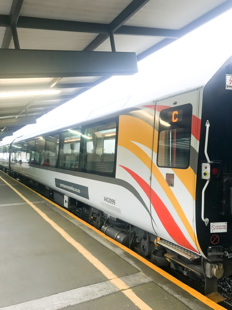
I took the TranzAlpine train, described as one of the greatest train journeys in the world, from Christchurch to Greymouth – it currently departs Addington Station at 8:15 am Friday to Monday, arriving in Greymouth at 1:05pm before commencing it’s return journey to Christchurch an hour later.

Taking the train during the pandemic
With New Zealand’s borders still closed to International visitors, physical distancing was easily possible and there were just two carriages of seating. The open viewing carriage was at the front of the train and the cafe at the back. Seating had been allocated and was generally on right-hand-side of the train suggesting this would be where the best views would be, and the open viewing carriage never got too crowded.
The cafe carriage was open however it was not possible to sit in there and food had to be taken back to our seats. Face coverings needed to be worn whenever we were boarding, disembarking or moving about the carriages but we could sit in our seats without them.

The TranzAlpine train journey
It was a concerningly foggy day as we left Christchurch and started down the main trunk line to Rolleston Station, with no sign of some of the initial scenery mentioned in the audio such as the Port Hills.
Our first real views were of the Canterbury Plains – the most agriculturally altered part of New Zealand since pre-settler times. From the train you can see trees planted as windbreaks and shelter for animals among the vast fields of grass.

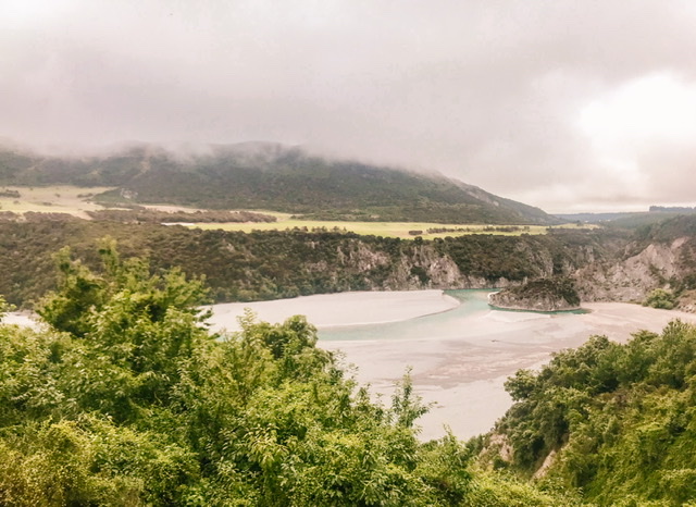
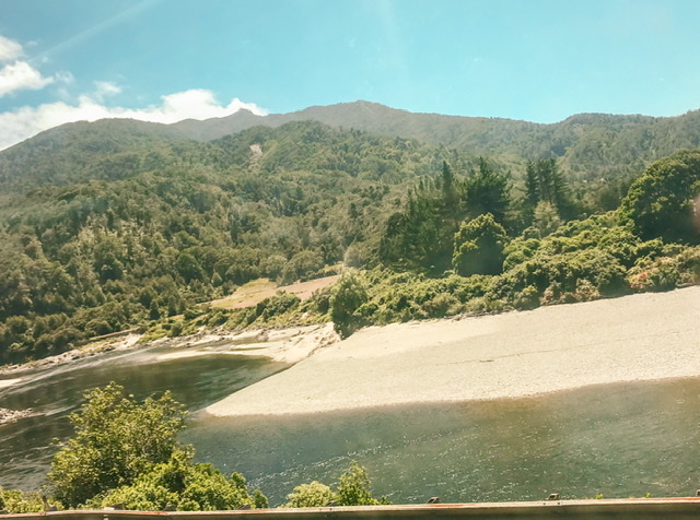
After Springfield Station began a series of 15 tunnels and four viaducts which is the most talked about part of the TranzAlpine route. From the viewing carriage we got our first glances of the Waimakariri River running alongside the train. Here the sun began to appear and the viewing carriage quickly filled up.

The next stage of our journey had the iconic views of the Southern Alps. Snow covers the top third of the Southern Alps from May to September and a few day each year the snow comes as far down as the rail line. In peak Summer there was still some snow and ice cover over the highest peaks.
The tussock desert landscape reminded me of Waiouru in the centre of the North Island.

We passed through Craggyburn Station where merino and cattle are farmed and past the Craggyburn range and ski-fields.
We saw the red Cass Train Station, pictured in the famous from the Rita Angus painting, before we rejoined the Waimakariri river as we approached Arthurs Pass National Park. Crossing the low bridge over the Waimakariri (as featured in much of the TranzAlpine’s marketing material) with the alps in the background was a highlight of the journey.
Another river which ran alongside the tracks for a time was the Mingha River which features in the famous annual Coast to Coast, and there was miles and miles of beech forest – unsuitable as a mass building timber it has never been logged.
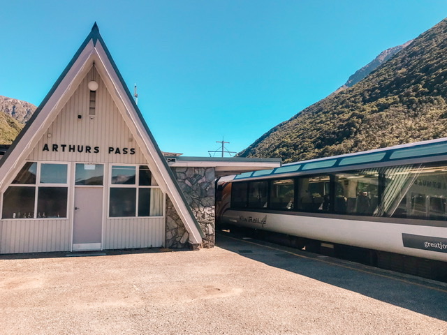
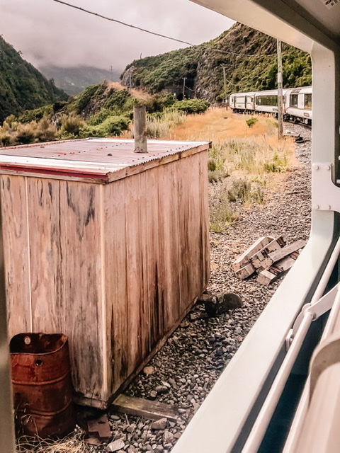
After a quick stop at Arthurs Pass where we could get off the train and stretch for five minutes, the journey really started to slow down.
The 8.5km Otira Tunnel cuts us through the main divide – the local name for the conjoint mountain ranges of the Southern Alps between the East and West Coasts which runs south from Arthurs pass to Hass pass. When it was completed in 1923 it was the world’s second longest tunnel.
Now being on the the South Island’s West Coast, famous for it’s rain, the scenery was suddenly lusher and quite different. We travelled through valleys carved out by glaciers and between the hills, with huge riverbeds running alongside the tracks.
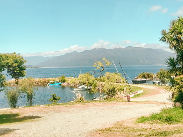
We passed through Moana, the final station before Greymouth, a lake settlement on the shore of Lake Brunner where people waved at the train from modern holiday homes.
The final stretch to Greymouth is through the Grey Valley, where much of the forest cover is secondary growth due to toxins from coalmining killing off vegetation. We passed the site of the Old Brunner Mine, the site of New Zealand’s worst mining disaster in 1896.
Some of the (excellent) audio which we were provided headsets for is a little dated – for example the expected population growth projections given for Rolleston were more than two years out of date, and the Christchurch Earthquakes (2010-11) were mentioned as a large setback for tourist numbers while the current pandemic was not.
I think the afternoon return TranzAlpine train journey from Greymouth to Christchurch would be clearer and a Winter trip would have the added awe of snow-covered alps.
As there was no rental car availability in Greymouth, after a night at Noah’s Ark Backpackers, my return journey to Christchurch following a night in Christchurch at was via an East West Coaches shuttle. This went through Arthurs Pass and I’d recommend the journey as it allowed me to see the epic scenery from the road.

