
One early January morning while staying between Hastings and Napier, I set off early on the Rongokako (Blue) Te Mata Peak walk in Havelock North, wanting to get up and back before the Hawkes Bay summer heat set in for the day.
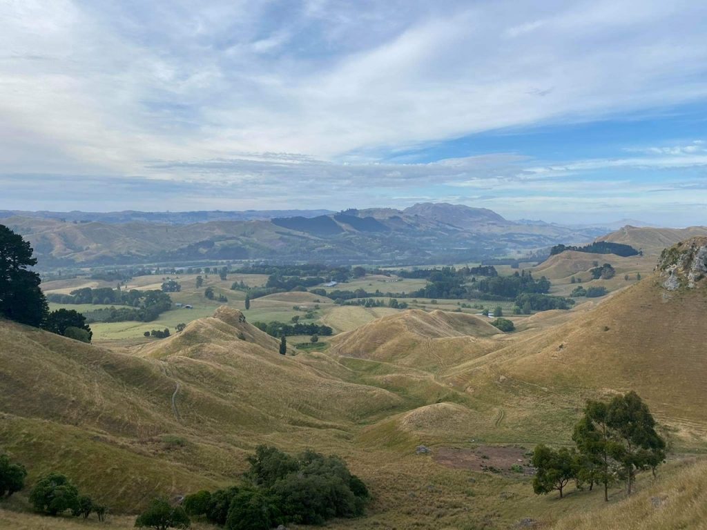
The limestone Te Mata Peak and surrounding jagged hills were uplifted from the sea floor through geological forces 2 million years ago. The land was inhabited by Māori tribes, before European settlers claimed it, then in 1927 it was gifted to the community from family ownership for everyone to visit and enjoy.
The main gates open at 5am but I still had my pick of the parking spaces in Te Mata Park when I arrived shortly before 7am.
The Rongokako (Blue) Te Mata Peak Walk
Two large signs depict the five walking tracks and numerous mountain bike trails and you can choose between. I chose the Rongokako (Blue) walking trail as it went to the 399 metre summit without the promised difficulty of the Giant (Red) circuit.
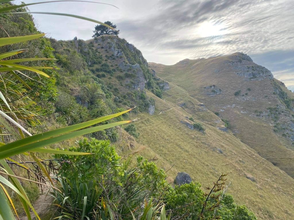
The blue trail does not take a straight path up to the summit, instead taking a loop through a range of scenery. There were several places early on where I was confused as to which path I should take and more markers would have been immensely helpful.
Early on walkers also share the trail with curious sheep who seemed unsure whether to run along in front of me and take the Te Mata Peak hike ahead of me or get out of the way.
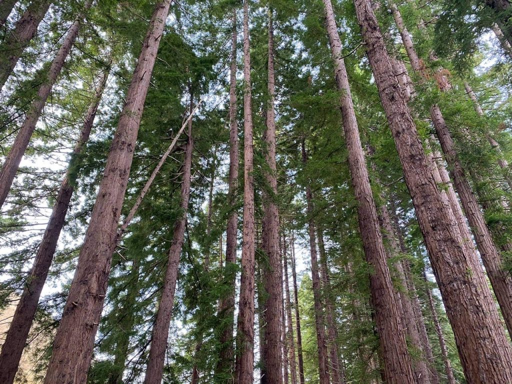
The Te Mata Park Trust is in the midst of a native regeneration project, planting 59,000 native plants to improve biodiversity and provide native New Zealand species with better habitats. On an initial downhill treck it was cool seeing the baby trees lining the trail as well as the towering, established redwood trees nearby.
The Redwood forest section is small but impressive before the climb begins. These 223 trees were planted in 1927 and now tower over 40 metres high.
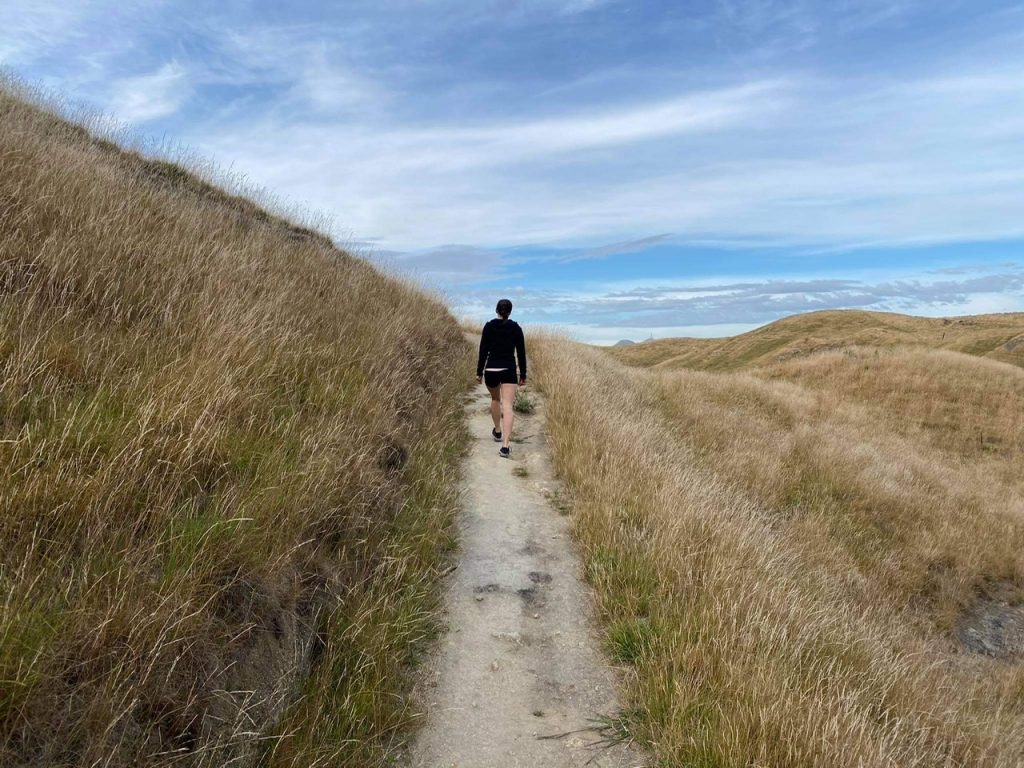
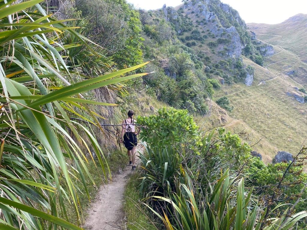
The trail is narrow pretty much the entire way and I kept giving way to runners (people too fit to be the type kicking off New Years resolutions to get fit) and dogs. Soon enough you’re at a height where the Hawkes Bay views to start kicking in.
The steepest section is certainly not for the faint hearted – it’s narrow, steep and rocky with sheer drops either side. It’s also crazy seeing fossilised marine life underfoot at such a height and so far from the coast.
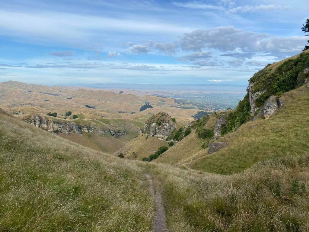
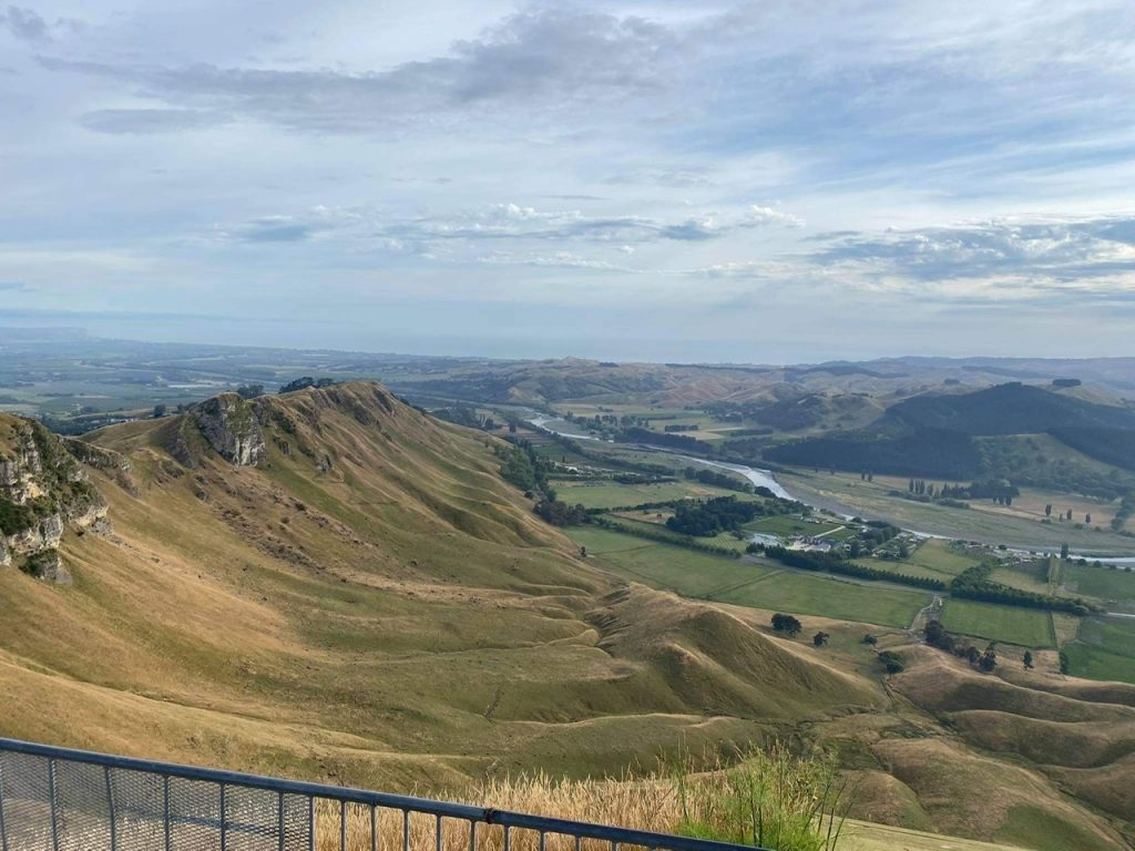
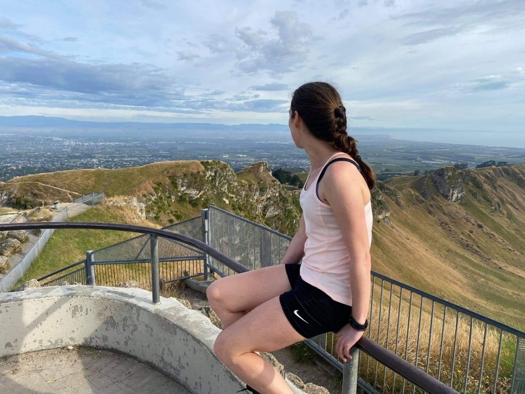
Finally reaching the summit of Te Mata Peak is rewarding – you can see the Tukituki River, Craggy Range winery, the Heretaunga planes, and panoramic views of the Ruahine, Kaweka and Maungaharuru Ranges and Cape Kidnappers. It was a bit hazy but on a clear day you can see as far as Mount Ruapehu and Mahia Peninsula.
The hike down was much easier down but it also lacked the bang for buck – if your joints are in need of some relief I’d recommend just walking along the road!
While the signs suggested the Te Mata Peak walk taking the Rongokako (Blue) trail would take 2 hours and 5 minutes, most people would be able to do it within an hour and a half. If there has been recent rain the track can be slippery and dangerous.

